Cold and blustery conditions continue in Philadelphia, tracking next chance for rain
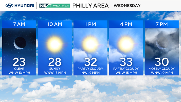
Wednesday and Thursday remain chilly in the 30s with sun and clouds and cold windchills across the Philadelphia region. A warm front will approach the area, bringing the chance of a few snow flurries on Thursday. Otherwise, our dry stretch continues.
By Friday the clouds clear and temperatures rebound to the low 40s.
We are tracking another storm Saturday for the start of the long Martin Luther King Jr. holiday weekend. Highs Saturday will be in the 40s with rain possible late that day. Temperatures will start falling Saturday night, and there is a chance of the rain mixing with snow, especially in the Poconos.
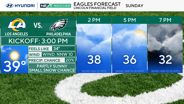
Sunday will be mostly cloudy and cooler in the upper 30s. As of now, the forecast models differ, but we're introducing a chance for a few snow showers for the area, mainly afternoon and evening. It's not looking like a significant event, but crazier things have happened in the world of weather. We'll keep you posted.
On the holiday Monday, highs will likely stay below freezing under partly cloudy skies.
It's looking like another potent push of Arctic air will arrive in the area next week, delivering a stretch of several days when our high temperatures will not get above freezing.
Here's your 7-day forecast:
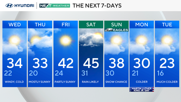
Wednesday: Windy, cold. High 34, Low 22.
Thursday: Mostly sunny. High 33, Low 20.
Friday: Partly sunny. High 42, Low 24.
Saturday: Rain likely. High 45, Low 31.
Sunday: Snow chance. High 38, Low 30.
Monday: Colder. High 30, Low 21.
Tuesday: Much colder. High 23, Low 16.